Through modern innovation in the current age, satellites and space stations are integral for space exploration, scientific discovery, communications, and remote sensing. However, producing and implementing orbital systems is incredibly costly, both financially and environmentally. New technological advancements increasingly require the use of satellites, but with the mounting global ecological crisis, how essential are they?
—
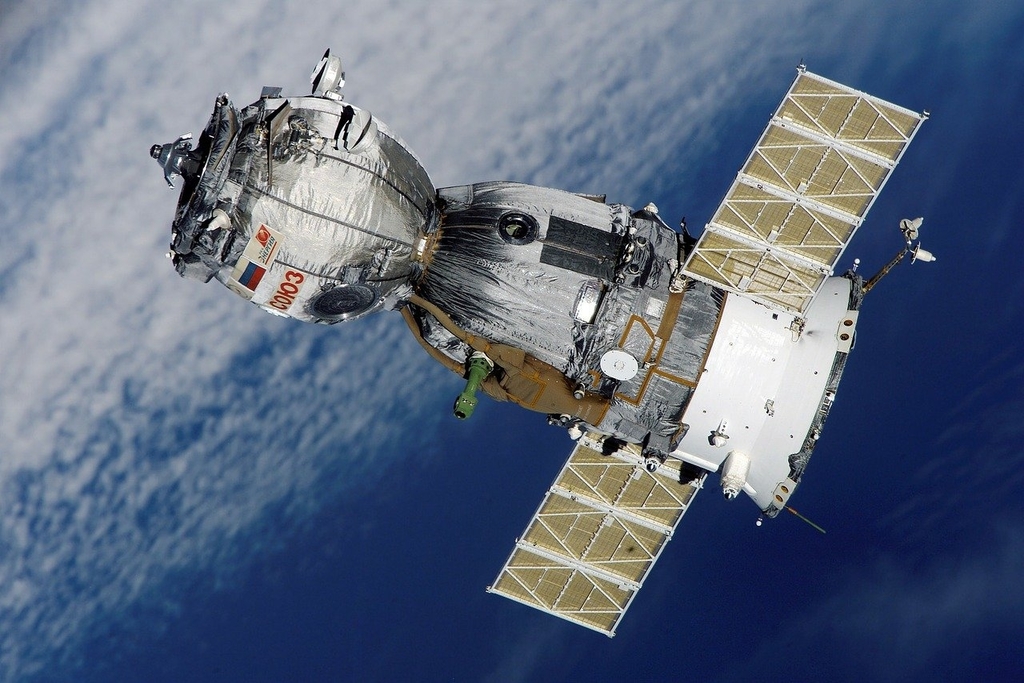
Over 2 200 active satellites are orbiting Earth, with the US leading with the most satellites per country, followed by China and Russia. In 1966, only six states were participating in the ‘space race’; now, there are 72 countries with active programmes or satellites in orbit. Many satellites are controlled by governing bodies and institutions that cover individual states or trade blocs, such as the National Aeronautics and Space Administration (NASA) in the US and the European Space Agency (ESA), or by national military departments. However, the vast majority of satellites are currently owned and controlled by private firms, an industry that has rapidly expanded in the past decade. The private space sector is experiencing a new uptick in scientific- or business-related endeavours, causing the number of active satellites in orbit to increase by the month.
Elon Musk, founder and CEO of SpaceX, is launching one such endeavour, called Starlink, a network of low Earth orbit (LEO) satellites that will eventually create a global communications system capable of high-speed broadband internet connections. By the end of 2020, SpaceX is set to launch over 1 400 new satellites to ensure global coverage by 2021, and over 12 000 satellites over the next eight years. Latest reports suggest that number will increase to as many as 42 000 satellites in total, meaning that one single enterprise – SpaceX – will launch and have control of more satellites than have ever been launched since 1957. Starlink purports to be a ‘clean’ satellite constellation, whereby the LEO satellites will de-orbit to keep space clean once their lifespan is complete. However, it is debatable as to how clean the production and launches of thousands of satellites will be in reality.
SpaceX is not the only new commercial space-venturing company. OneWeb, based in the UK, Blue Origin, founded by Amazon founder, Jeff Bezos, and the Luxembourg-based SES, which is already one of the largest satellite operators in the world, are among many firms looking to the stars to expand into the highly lucrative sector. These enterprises, along with other new government-led and research-based programmes, suggest a recent boom in the space economy that shows little signs of slowing down. Aside from the economic worth of the global satellite industry, which was estimated to be US$360 billion in 2019 (both commercial and government-led), there are many other advantages for society from utilising outer space.
The Role of Satellite in Climate Change
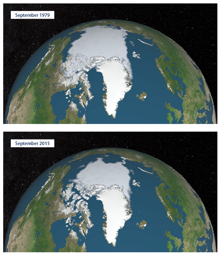
Satellites have a wide range of benefits. However, there are several important uses in the frame of the climate change. From the International Space Station (ISS) to hundreds of other observational satellites, remote sensing allows for climate and environmental monitoring. These imaging satellites are an incredible source of data for climate change research, enabling us to see the global changes on the planet that are happening more frequently, and with data freely available for anyone to view and use. For example, changing oceanic temperatures, currents and rising sea levels can be monitored by space-based research instruments. ISS measurements have indicated that global sea levels have increased by an average of 3.3 millimetres per year since 1993, due to melting glaciers and sea ice, and from thermal expansion within the oceans. Additionally, satellite imagery can show the changing sizes of glaciers and sea ice, which show that after 2017, 2019 had the second-lowest sea ice extent in the Arctic since 1978, with a similar situation in the Antarctic’s sea ice extent and coverage.
Remote sensing satellites, such as NASA’s Global Precipitation Measurement (GPM) satellite, can determine the changing precipitation patterns and flooding. Rainfall changes indicate that globally, more extreme weather events are happening, with more droughts, flooding and hurricanes. Vegetation cover changes are also observable, even with the naked eye from space. Along with NASA’s GPM, ESA’s Copernicus Sentinel-2 satellite enables spatial mapping of biodiversity and biomass, agricultural impacts, soil degradation, forestry cover and deforestation (and afforestation). Understanding this is essential for understanding the bigger picture for better ground-level mitigation and management of degradative land uses, such as intensive agricultural practices.
Observations of how widespread wildfires have been would not have been possible without a satellite’s viewpoint, showing worsened conditions of increasing fire risk, frequency, and magnitude as a result of climate change, which also feedbacks to increase carbon dioxide emissions. In the recent (and ongoing) Australian bushfire crisis, satellite imagery has shown the extent of burnt land in the country, and the distance the smoke travelled at the peak of the fire season, reaching as far away as South America. More recently, satellite images have shown that nitrogen GHGs have dropped in areas affected by COVID-19 quarantine measures, such as in China and Italy.
Greenhouse gases (GHGs) and temperature changes are also monitored from satellites, making them essential in modelling past, present and future differences to understand the atmospheric, terrestrial and oceanic implications from climate change. Instruments such as NASA’s Atmospheric Infrared Sounder (AIRS) satellite can measure GHG increases, such as CO2. Carbon dioxide levels are regularly monitored from space, showing that atmospheric CO2 levels have reached 413 parts per million (ppm). This is the highest concentration of CO2 that our planet has experienced in 3 million years. Satellites can also detect other GHGs, such as methane and nitrous oxide, which often come from industrial leaks or oil and gas fields. Satellites are integral for compliance with international environmental treaties such as the Paris Agreement. In aiming to keep within the Agreement’s target of mitigating global warming to 1.5°C above pre-industrial temperatures by the end of the century, satellites show we are already at 0.98°C above, a number that fluctuates annually.
Aside from the fundamental need to understand climatic changes from space, satellites are useful for early warning systems for natural disasters, the increased occurrences of extreme weather events, or ‘human disasters’. Satellites can monitor weather events in case of necessary evacuations, such as hurricane or flooding events, which are usually in conjunction with land-based monitoring systems and institutions (e.g. National Oceanic and Atmospheric Administration (NOAA) in the US). For natural disasters such as earthquakes, tsunamis or landslides, satellites are just as important in answering disaster events. Satellites have even been able to detect minute changes in human-made infrastructures, such as monitoring changes in road surfaces before a bridge collapse.
However, despite the array of advantages of satellites in the climate crisis, what are the implications and costs of utilising the space beyond our immediate atmosphere?
Space exploration and entrepreneurship are very costly ventures. Sourcing the parts for satellites is expensive due to the amount of rare and valuable materials within them; production, engineering and software costs are similarly very high, often upward of US$100 million per satellite. Consequently, only states, companies, and individuals with significant disposable capital (or those with sponsorship from state or private funds) can viably finance space programmes. As a result, there is a disproportionate allocation of control over space from entities and institutions that can financially support such ventures, prohibiting many countries from accessing the benefits of satellite control.
The pollution crisis of the Earth’s waterways is well-documented. This notion is reflected beyond our atmosphere. Space debris is an issue that is not often talked about; apart from the International Space Station (ISS), most people will never have contact with outer space, and therefore it is not often an immediate concern.
Old shuttles and satellite parts enter the planet’s atmosphere on a reasonably regular basis, estimated at 200-400 pieces a year. While these parts frequently burn up upon re-entry and have minimal direct impact on terrestrial regions, they do not disappear completely. By burning up, due to the intense friction of travelling from a vacuum to an atmosphere full of gases, noxious chemicals and GHGs are released in the upper atmosphere. These gases, while negligible in amount, are generally more potent than CO2, and can deplete the ozone layer or retain more thermal radiation.
Estimates by ESA put the number of space junk objects in Earth’s orbit at approximately 900 000 objects over 1cm in size, of which around 5 400 of those are larger than one metre (including over 2 000 active satellites). Roughly 70% of these pieces are in LEO. Space debris can be anything from bolts, paint chips and instrument parts, to entire defunct satellites and rocket bodies. Any object 10cm in size or larger can have a significant effect on active spacecraft due to the high speeds that objects orbit at; most modern satellites and stations are fitted with debris shields for smaller pieces.
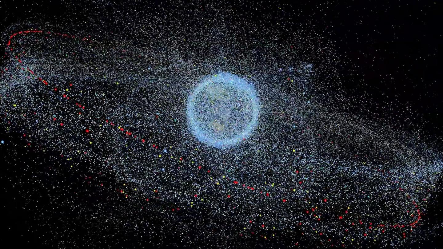
Historically, space junk has destroyed active satellites, creating more debris in the process. In the future, a chain reaction of colliding space debris, known as the Kessler syndrome, could render LEO unusable. Such a reaction could inhibit the possibility of communication and essential remote sensing satellites that many people and organisations around the world rely on every day. It could also dissuade future space programmes from taking place due to the threat of extra-terrestrial debris. The implications of adding Starlink’s potential 42 000 new space instruments into orbit over the next decade or so, not to mention others, are innumerable in terms of impacting the already-fragile environment.
More positively, there have been several operations seeking to remove such debris from space. In 2018, British satellite RemoveDEBRIS was launched and deployed from the ISS to test new technologies that were successful in capturing space debris. Alternatively, another way to mitigate space debris in altitudes where satellites typically orbit is to move them to a ‘graveyard orbit’, where instruments near the end of their lifespan are sent to altitudes of 225 miles from Earth’s surface and higher, although this does not entirely solve the space junk crisis.
Unsurprisingly, the requirements for constructing a satellite make them incredibly resource-intensive. An immense array of elements and raw materials are used to create space structures; kevlar, aluminium, silicon, titanium or composite alloys such as nickel-cadmium and aluminium-beryllium are often essential. This is without considering the many resources necessary for electrical systems onboard the satellite, and the methods of building the space-faring instruments. The mining of metals alone is highly energy-intensive and degradative to the surrounding environment, including atmospheric and groundwater pollution. Following extraction, deoxidation or purification of the resources also contribute to the total emissions, along with transportation of the materials to production facilities.
The effects of launch emissions from solid rocket fuel are not well understood and are difficult to measure. The majority of satellite launches produce a negligible amount of CO2, especially in comparison to other industries. However, particulates produced in the launch interact in the stratosphere and have a significant impact on ozone depletion. For instance, alumina particles are emitted from the launch and absorb sunlight, enabling thermal heating in the upper stratosphere and causing positive feedback and further latent warming. The effects of other gases and particles’ interactions with upper atmospheric environs have yet to be modelled, meaning every new rocket launch has unknown and potentially critical implications for climate change.
Some reports state that liquid hydrogen, an alternative rocket fuel to solid propellants, is almost carbon neutral with 28 tons of CO2 per launch, alongside water vapour. However, the impacts of initially creating the specialised liquid fuel are estimated to be upward of 672 tons of CO2 per launch due to the industrial-scale amount of energy needed to produce the fuel, meaning the supposedly ‘clean’ fuel type is not as green when taken at face value. Ironically, satellite imaging will likely be the most effective tool in understanding the upper atmosphere’s composition and the impact of space programmes’ launch emissions on the atmosphere.
Satellites are incredibly important in understanding and combating climate change. Understanding the climate crisis and its related issues are integral to combating it- if we cannot measure it, we cannot mitigate it. Without satellite capabilities, the knowledge and data on global warming and climate change today would not be anywhere as close to what we have available now, even with land-based sensing equipment. Nevertheless, there are implications and costs associated with satellites. When considering the Starlink programme, the overall impacts caused by one single private firm will be vast. There will be knock-on effects well into the future, such as production pollution, launch emissions from tens of thousands of satellites, and space debris. It is debatable as to how necessary a slightly higher coverage and faster internet speed will be in light of the ever-imminent climate crisis.
With the onset of a ‘new space race’, policymakers need to be taking a serious look at the environmental costs of satellite use and improving research capabilities and regulation in order to mitigate these degradative implications. Future programmes need to invest in reducing or offsetting emissions and taking more responsibility for satellites once they have reached the end of their life. In the case of active satellites, retrofitting them to be less resource- or emission-intensive could be a viable solution in aiding this, depending on future technological and engineering advancements.